Amsterdam Metro
It takes me half an hour to get to work each day. Trams 1, 2 or 5 get me to Central Station then I get metro 54 to Bijlmer.
Although the metro is a rapid-transit system connecting various parts of the city, it’s not the mode of public transport used in the city centre (Amsterdam Centrum), the only part of the city that tourists tend to visit. There, the tram is king. Working in Bijlmer, on the outskirts of the city, I need to use the metro. Even though it connects far-flung bits of the city, it only consists of 4 lines at present. Born in 1968 and compared to the great metro systems of the world, like the Paris Metro and London Underground, it’s a very modest and much younger cousin.
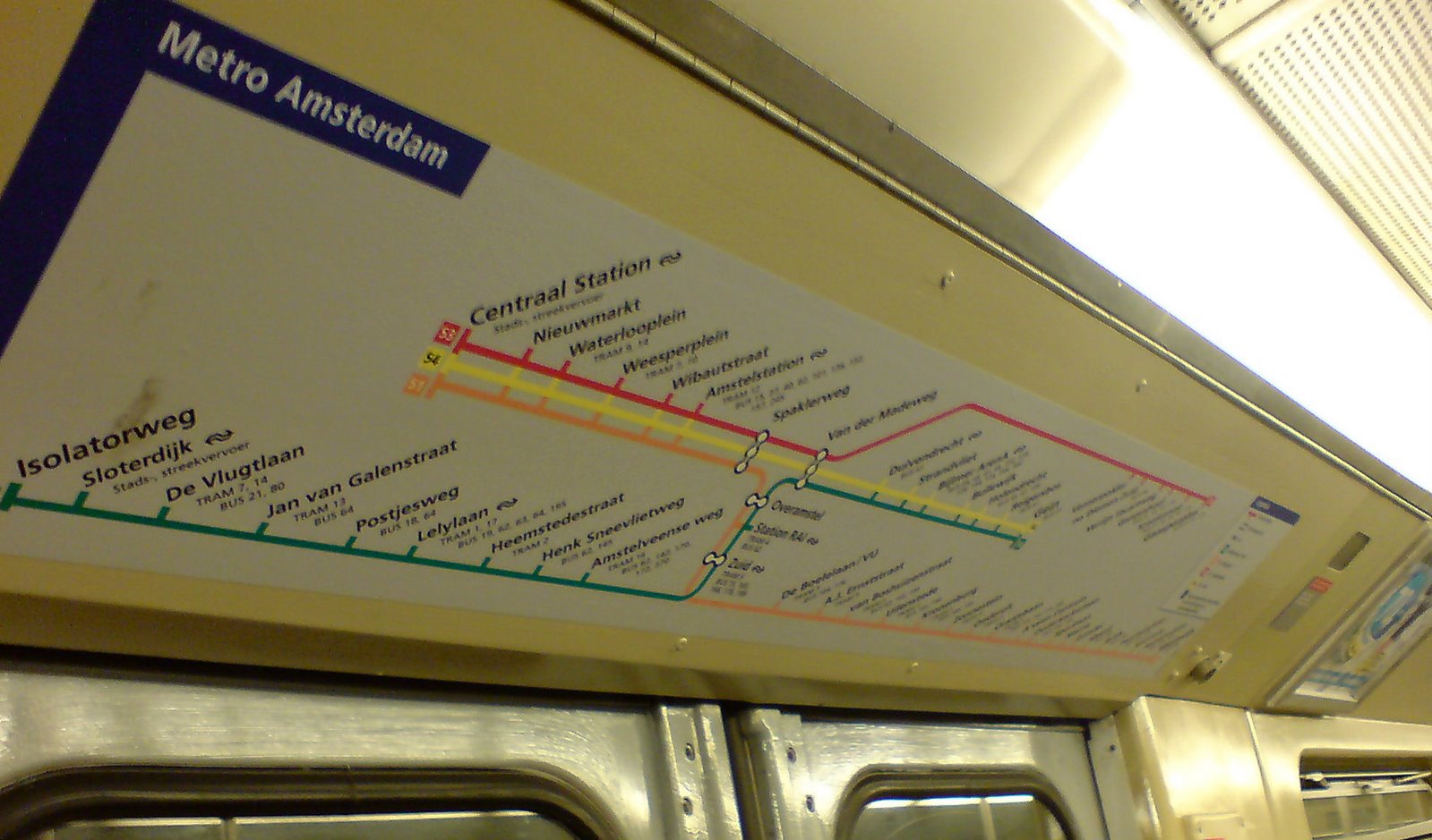
It took me about 6 weeks before I noticed something familiar about the metro map. I was standing in a packed carriage on my way home and peering through the tall Dutch men at the map above the doors, checking how many stops were left before I got to Central Station.

When the carriage emptied of passengers, I took the pic above. The angle isn’t great but for those of you who know the London Underground, you’ll know why I was reminded of it.
 I had a closer look at the metro map on the platform. The similarity was still there but not quite as strong. With only four lines spread across a representation of the entire Amsterdam region, the similarity is less obvious. It wasn’t quite as much of a reminder of the London Tube as the compressed map in the carriage was. In the bottom right-hand corner of the map, I noticed that the map had been produced with permission from the London Transport Museum.
I’d come across my first example of another public transport map based on Harry Beck’s iconic London Underground map.
Although the Amsterdam metro map has been called a soulless copy of the London Underground map, with only four lines, what else could it be? Soulless or not, it also spawned its own version of the infamous Tube anagram map. For all sorts of annoying legal reasons, the map was removed from its original site but it can still be seen here.
As to be expected, the anagrams are Dutch words. Many of them are very funny but not of much use to a person who can’t speak Dutch. I could translate them (or get them translated) but, instead, have decided to produce my own version with English words. Yes, I know that I’ve come to the party late but I seem to be good at that. With a good anagram generator it’s a simple thing to do but some of the shorter station names were problematic. Being Dutch, they make use of Dutch word constructions which differ from those in English. There were a number of them that didn’t produce any anagrams in English. So I cheated by tacking on ‘station’ to the station name to get an English anagram. I did it with these stations: Bijlmer, Brink, Bullewijk, Gein, Westwijk and Zuid.
Here you have my version. If you click on the map you'll be taken to another page where you can hover your cursor above the station name to get its proper name.

So my daily commute isn’t between Central Station and Bijlmer but, depending on which map you use, it’s either between ‘Notelaars Intact’ (Whole Walnut tree) and ‘Belrijm’ (rhyming bell) or ‘Raincoat Talents’ and ‘Tom Jib’s Latrine’.
Although the metro is a rapid-transit system connecting various parts of the city, it’s not the mode of public transport used in the city centre (Amsterdam Centrum), the only part of the city that tourists tend to visit. There, the tram is king. Working in Bijlmer, on the outskirts of the city, I need to use the metro. Even though it connects far-flung bits of the city, it only consists of 4 lines at present. Born in 1968 and compared to the great metro systems of the world, like the Paris Metro and London Underground, it’s a very modest and much younger cousin.
It took me about 6 weeks before I noticed something familiar about the metro map. I was standing in a packed carriage on my way home and peering through the tall Dutch men at the map above the doors, checking how many stops were left before I got to Central Station.
When the carriage emptied of passengers, I took the pic above. The angle isn’t great but for those of you who know the London Underground, you’ll know why I was reminded of it.
 I had a closer look at the metro map on the platform. The similarity was still there but not quite as strong. With only four lines spread across a representation of the entire Amsterdam region, the similarity is less obvious. It wasn’t quite as much of a reminder of the London Tube as the compressed map in the carriage was. In the bottom right-hand corner of the map, I noticed that the map had been produced with permission from the London Transport Museum.
I’d come across my first example of another public transport map based on Harry Beck’s iconic London Underground map.
Although the Amsterdam metro map has been called a soulless copy of the London Underground map, with only four lines, what else could it be? Soulless or not, it also spawned its own version of the infamous Tube anagram map. For all sorts of annoying legal reasons, the map was removed from its original site but it can still be seen here.
As to be expected, the anagrams are Dutch words. Many of them are very funny but not of much use to a person who can’t speak Dutch. I could translate them (or get them translated) but, instead, have decided to produce my own version with English words. Yes, I know that I’ve come to the party late but I seem to be good at that. With a good anagram generator it’s a simple thing to do but some of the shorter station names were problematic. Being Dutch, they make use of Dutch word constructions which differ from those in English. There were a number of them that didn’t produce any anagrams in English. So I cheated by tacking on ‘station’ to the station name to get an English anagram. I did it with these stations: Bijlmer, Brink, Bullewijk, Gein, Westwijk and Zuid.
Here you have my version. If you click on the map you'll be taken to another page where you can hover your cursor above the station name to get its proper name.
So my daily commute isn’t between Central Station and Bijlmer but, depending on which map you use, it’s either between ‘Notelaars Intact’ (Whole Walnut tree) and ‘Belrijm’ (rhyming bell) or ‘Raincoat Talents’ and ‘Tom Jib’s Latrine’.
posted by Reluctant Nomad at 15:39
![]()


0 Comments:
Post a Comment
<< Home